
Satellite remote sensing is a very efficient observation technology which allows to obtain information of a wide area at one time. Monitoring the marine and coastal environments in the NOWPAP region by remote sensing constantly can help detecting and addressing environmental problems at an early stage.
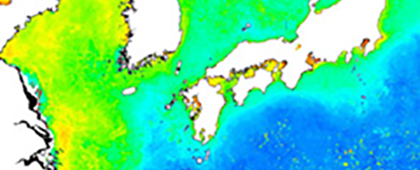
Currently, it is possible to observe a wide range of environmental information from satellites, such as sea surface temperature (SST), chlorophyll a concentration, sea level and wind speed at sea.
CEARAC Activity
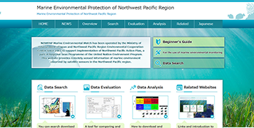
In order to promote marine environmental monitoring by utilizing information from satellites, CEARAC opened a website “Marine Environmental Watch” under the auspices of the Ministry of the Environment, Japan, to provide data, for example sea surface temperature (SST) and phytoplankton (chlorophyll a) in the NOWPAP region, which were observed by satellites. CEARAC has also conducted four training courses on remote sensing data analysis, and 91 people from 14 countries and regions (including the NOWPAP member states) have taken part in the courses. The training courses consist of lectures and hands-on sessions, and participants can learn practical use and application of remote sensing technique to water quality monitoring and/or seagrass mapping.
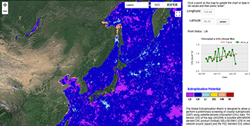
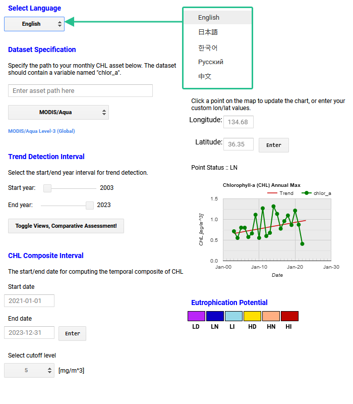
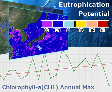
CEARAC also applies remote sensing technique to detect potentially eutrophicated areas in the NOWPAP region. In addition, Global Eutrophication Watch, a planetary scale tool for assessment of coastal eutrophication developed based on the NOWPAP Common Procedure is introduced on the CEARAC website. We also operate Seagrass Mapper, a tool for mapping seagrass beds in coastal areas using cloud technology.
・A manual for seagrass and seaweed beds distribution mapping with satellite images (2015)
・Integrated Report on Ocean Remote Sensing for the NOWPAP Region: Towards Assessment of the Marine and Coastal Environment (2011)
・Eutrophication Monitoring Guidelines by Remote Sensing for the NOWPAP Region (2007)
・Integrated Report on Ocean Remote Sensing for the NOWPAP Region (2005)
・National Reports of Ocean Remote Sensing in the NOWPAP Region (2004-2005)
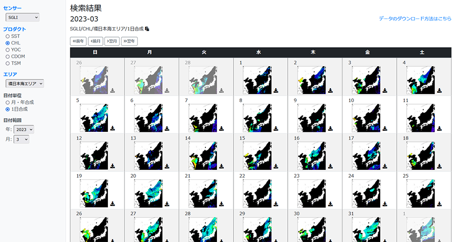
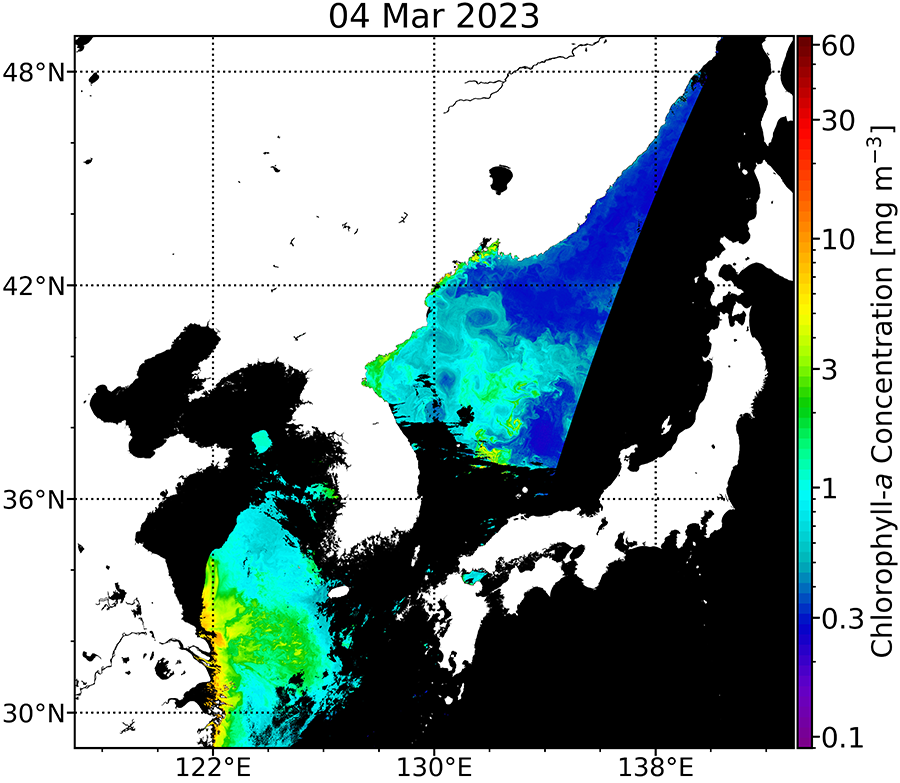
For detailed explanations of satellite data and instructions on how to use the app, please visit the site.
For detailed instructions, please refer to the manual page.
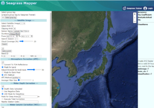
For information on how to use the app, please see the help page of Mapseagrass.


