NOWPAP – PICES Joint Training Course on Remote Sensing Data Analysis
October 21-25, 2013, Ocean University of China, Qingdao, China
Introduction
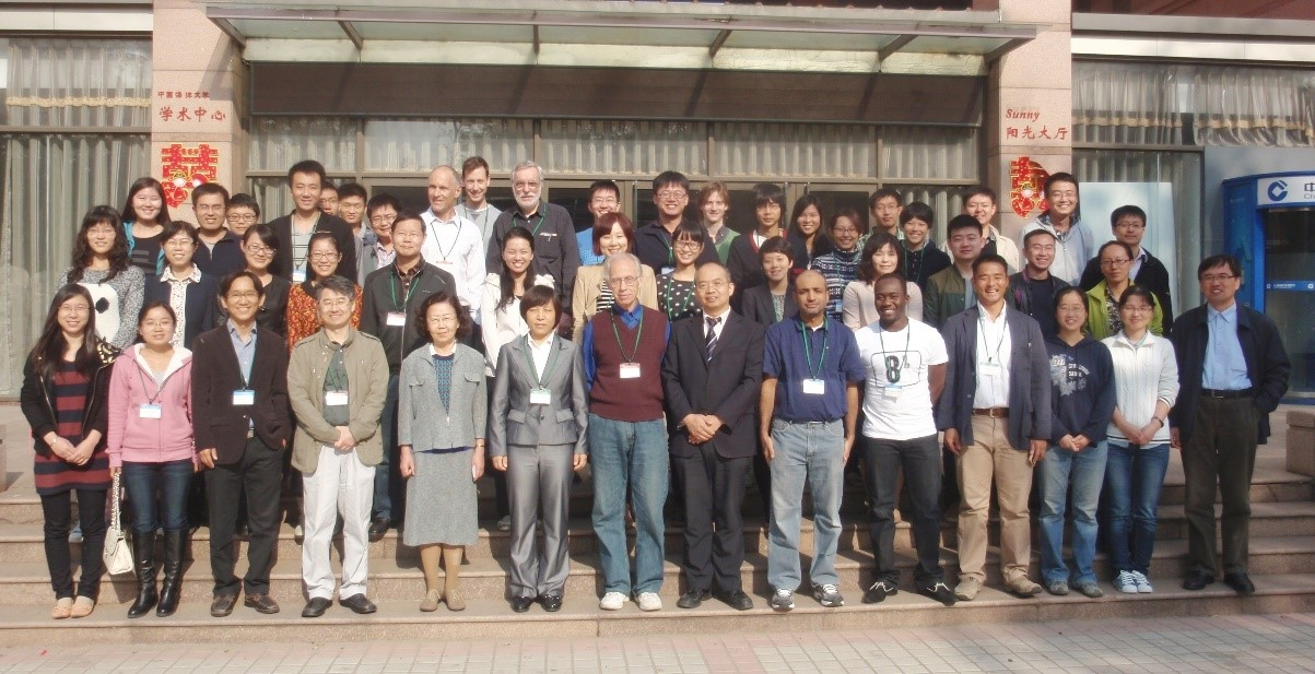
NOWPAP‐PICES Joint Training Course on Remote Sensing Data Analysis was held on October 21‐25 at Ocean University of China in Qingdao. Out of 73 applicants, the organizing committee selected 23 trainees. 7 lecturers gave trainees lectures and hands-on sessions on remote sensing techniques for monitoring and assessment of marine environment including Introduction to ocean color remote sensing, validation, time series analysis of ocean color data and preliminary eutrophication assessment by remote sensing.
Objective
To provide opportunities for postgraduate students, young professional researchers and coastal managers (including local government officers) working in the fields of marine sciences and coastal-zone management in the Northwest Pacific Region and adjacent area. The participants will gain useful skills and knowledge to utilize remote sensing data for monitoring and assessing the coastal and marine environment.
Date: October 21 to 25, 2013
Venue: Ocean University of China, Qingdao, China
Organization Structure
・Organizers:
Northwest Pacific Action Plan (NOWPAP)
North Pacific Marine Science Organization (PICES)
・Local organizers and local host institutions:
Chinese National Environmental Monitoring Center
Ocean Remote Sensing Institute, Ocean University of China
・Supporters:
International Ocean Colour Coordinating Group (IOCCG)
・Secretariat:
Special Monitoring & Coastal Environment Assessment Regional Activity Centre (CEARAC)
Course Fee
Training course was provided for free of charge.
Trainees
23 trainees from 5 countries were selected out of 73 applicants by screening by the Organizing Committee consisting of experts in CEARAC and PICES, based on the contents of submitted applications.
| Country | Number of Trainees |
| China | 19 |
| Korea | 1 |
| Cameroon (Brunei) | 1 |
| Canada | 1 |
| Oman | 1 |
| Total | 23 |
Lecturers
| Country | Name | Title / Organization |
| China | Dr. Zhihua MAO | State Key Laboratory of Satellite Ocean Environment Dynamics (SOED), Second Institute of Oceanography |
| China | Dr. Chaofang ZHAO | Professor / Ocean Remote Sensing Institute, Ocean University of China |
| Japan | Dr. Joji ISHIZAKA | Director, Professor / Hydrospheric Atmospheric Research Center, Nagoya University |
| Korea | Dr. Young-Je PARK | Principal Researcher / Korea Ocean Satellite Center (KOSG), Korea Institute of Ocean Science and Technology (KIOST) |
| Russia | Dr. Leonid MITNIK | Head of Department / Satellite Oceanography, V. I.II’ichev Pacific Oceanological Institute, Far Eastern Branch of the Russian Academy of Sciences |
| Germany | Dr. Roland DOERFFER | Head of Department / Optical Remote Sensing Lab, GKSS Institute for Coastal Research |
| USA | Dr. Mati KAHRU | Project Scientist / Scripps Institution of Oceanography, University of California |
Course Program
| Date | Time | Program | Lecturer |
| Oct 21 | 9:00-9:20 | Welcome address | - |
| 9:20-10:50 | Introduction to Satellite Oceanography (L) and recent progress in ocean color remote sensing part I: Uncertainties in ocean colour remote sensing (L) | Dr. Roland DERFFER | |
| 11:00-12:30 | Introduction and recent progress in ocean color remote sensing part II : Correction of the influence of the atomosphere in Ocean colour remote sensing (L) | Dr. Roland DERFFER | |
| 13:30-15:00 | Ocean color remote sensing for Case 2 waters(L) | Dr. Zhihua MAO | |
| 15:15-17:00 | Satellite Ocean Color: Challenges & the Software (L) + (H) | Dr. Mati KAHRU | |
| Introduction into MERIS data and BEAM software part I (H) | Dr. Roland DOERFFER | ||
| Oct 22 | 9:00-10:30 | Bio-optical properties in northeastern asian marginal seas derived from a decade of ocean color data (L) | Dr. Young-Je PARK |
| 10:45-12:15 | Introduction of GOCI and its applications (L) | Dr. Young Je Park | |
| 13:30-17:00 | Time series analysis of satellite data (H) | Dr. Mati KAHRU | |
| Oct 23 | 9:00-10:30 | Primary Production (L) | Dr. Joji ISHIZAKA |
| 10:45-12:15 | Eutrophication (L) Satellite based monitoring of marine and coastal environment of the Northwest Pacific (L) |
Dr. Joji ISHIZAKA | |
| 13:30-17:00 | Validation of satellite ocean color data (L) + (H) | Dr. Mati KAHRU | |
| Oct 24 | 9:00-10:30 | Utilization of the Landsat image (L) | Dr. Leonid MITNIK |
| 10:30-12:15 | Sentinel Missions of ESA/EUMETSAT (L) | Dr. Roland DOERFFER | |
| 13:30-17:00 | Introduction into MERIS data and BEAM software part-II (H) | Dr. Roland DOERFFER | |
| Oct 25 | 9:00-10:30 | Oil spill monitoring by remote sensing (L) | Dr. Leonid MITNIK |
| 10:50-12:15 | Oil spill detection by SAR and Lidar system(L) | Dr. Chaofang ZHAO | |
| 13:00-15:30 | Uncertainties in ocean colour remote sensing (H) | Dr. Roland DOERFFER | |
| 15:30-17:00 | Assignment for all trainees (H) | - | |
| 17:00-17:30 | Closing | - |
(L) = Lecture
(H) = Hands-on exercises