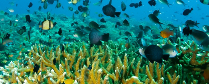
The NOWPAP region is one of the most diverse marine areas in the world, with many different environments, ranging from icy waters in the north in winter to warmer waters and deep-sea areas reaching up to 3,000 m in depth, creating a rich ecosystem that is home to many different organisms. In order to conserve this rich biodiversity, the tenth meeting of the Conference of the Parties to the Convention on Biological Diversity (COP10), held in Nagoya in 2010, agreed on the Aichi Targets, which stipulate that 10% of the world’s ocean areas should be designated as Marine Protected Areas (MPA) by 2020. Although countries around the world have made efforts, it seemed to be quite difficult to achieve the Targets, and further efforts were required. Under these circumstances, the Post-2020 Targets (Kunming-Montreal Global Biodiversity Framework) were established in 2022, which set ambitious targets for the post-2020 period, including the conservation of 30% of important terrestrial, aquatic, and marine areas by 2030 (30 by 30). To meet this target, it is encouraged to set other effective area-based conservation measures (OECMs) besides MPAs to expand the over-all protected areas.
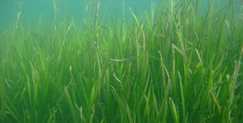
Following the adoption of the Aichi Target, CEARAC has implemented various activities on marine biodiversity including developing regional report on MPAs to collect and share useful information on how to designate MPAs in each NOWPAP member states. In recent years, CEARAC has focused on coastal ecosystem, in particular seagrass beds and tidal flats, and implemented monitoring and mapping activities of them with remote sensing techniques. Seagrass beds and tidal flats are important habitats for coastal organisms; however, the coverage of them has been decreasing by coastal development and/or worsened marine environment. By revealing historical changes of these habitats, CEARAC can contribute to the conservation of the coastal environment in the future.
The latest monitoring technique, environmental DNA is one of the special monitoring tool. CEARAC tried to share the cutting-edge techniques in Japan with the NOWPAP member states through developing manuals.
・3rd Expert Meeting on Marine Biodiversity and Eutrophication in the Northwest Pacific Region (2013)
・2nd Expert Meeting on Marine Biodiversity and Eutrophication in the Northwest Pacific Region (2011)
・1st Expert Meeting on Marine Biodiversity and Eutrophication in the Northwest Pacific Region (2010)
・Assessment of major pressures on marine biodiversity in the NOWPAP region (2018)
・Feasibility Study for Assessment of Seagrass Distribution in the NOWPAP Region (2018)
・Regional report on pilot assessments of impacts of major threats on marine biodiversity in the NOWPAP region (2017)
・Monitoring and management of Marine Protected Areas in the NOWPAP region(2013)
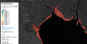
The developed map for the NOWPAP region shows the temporal change of the distribution of tidal flats from 1980s on.
Tidal Flats mapping →
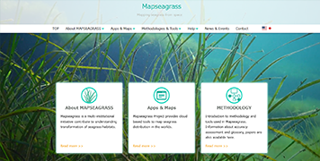
This website was developed by a multi-institutional project in which international organizations, universities, research institutes, NGOs and technology companies are involved, aiming to contribute to understanding transformation of seagrass habitats in coastal waters through mapping near real-time remote sensing data.
Visit Mapseagrass website for more details, e.g. operating instructions of Seagrass Mapper.